A reader writes:
Could it be Northern India? Or Central America? Or the Pacific Northwest? The modern stadium lights, lush green vegetation, and (possible) geothermal hotspot in the background make me think it's the latter. Or is it Iceland? Nah, too many trees. And that awning would be destroyed in the wind. I'll go with La Fortuna, Costa Rica. (Actual Google searches included "powerlines Costa Rica", "stadiums near powerlines", and "plants". Nothing was fruitful.)
Another writes:
Unless I'm missing something here, this is a tough one. The rounded mountains, high ground, low clouds, and manicured fields all tell me South Africa, although I admit my image of the nation is being distorted by this summer's World Cup. If I'm right, though, it's pretty clear to me it's the Western Cape, and likely the Misty Mountains. I'm going to go with north of Worcester, South Africa.
Another:
Well I'm sure you have plenty of winners on this one (the mountains with the flatirons are a DEAD giveaway). I know it's very close to Boulder, Colorado. The question really is, exactly where. Slightly northeast? Ah hell, it might even be Boulder, but my guess is Niwot.
Many guesses were in the Boulder area. Another:
This one doesn't seem too bad. Probably Pacific, possibly an island (of volcanic origin). Also, it appears to be somewhere a school and tree farm are adjacent. I'm guessing they might be Macadamia nut trees, and while not indigenous to the island, would point to Hawaii. I glanced quickly at the islands for Macadamia/School co-existence and will go with the Honaunau School in Captain Cook, Hawaii.
Another:
Waipio, HI? Couldn't get an address for this one, which makes me uncertain as to whether I'm even on the right continent. If forced to give a place (for proximity's sake), I'd say somewhere near Ka Uka Boulevard. The baseball diamond with the floodlights is one of very few on the island of Oahu. I've scoured private schools in Hawaii, floodlight manufacturers, power line grids, and still can't find the buildings (hoping Google Maps satellite is out of date), so I'm not sure this isn't Kyoto or something.
Another:
I'm a purist on these things - no Google satellite for this Van Winkle. Somewhere in Okinawa Prefecture, Japan? The baseball field, the Japanese-style roof beams, and what look like a couple Japanese schoolgirls. Plus some ugly houses and a Quonset hut in the background - maybe a U.S. base?
Several readers guessed military installations. Another:
I'm gonna guess Daegu, South Korea. The picture has an Asian feel, especially the fog-shrouded green mountains. There are two school girls in uniform. That, plus the volleyball net, suggest Japan or Korea. The building in the foreground (assuming it's a school) is not nice enough for Japan, so I'm going with Korea. Daegu is the biggest city in South Korea that sits in or near mountains. So Daegu it is.
Another:
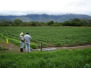
 This one has tropical vegetation, the construction is simple and does not reflect great wealth. The mountains appear to have a wet climate. My pulled-out-of-my-ass guess is Honduras. Since the picture was taken a plain looking to the mountains, and looking at a topographical map of Honduras on wikipedia, the candidates are in the region of Choluteca or Gracias a Dios. Since I'm guessing anyway I'll say: Honduras: Choluteca: El Triunfo (I've attached what I believe is a picture from the Choluteca region)
Oh, and I deserve a few points for spotting Andrew at the Dina Martina show on Saturday in Provincetown. My husband passed him in the men's room.
Another:
I look forward to this contest every Saturday morning, and more often than not, by 2:00pm, I find myself hopelessly frustrated. And here we are again ...


