| WPC Met Watch |
|
|
Mesoscale Precipitation Discussion: #1034 |
|
(Issued at 628 PM EDT Thu Sep 19 2024
) |
|
| MPD Selection |
|
|
|
|
|

Mesoscale Precipitation Discussion 1034
NWS Weather Prediction Center College Park MD
628 PM EDT Thu Sep 19 2024

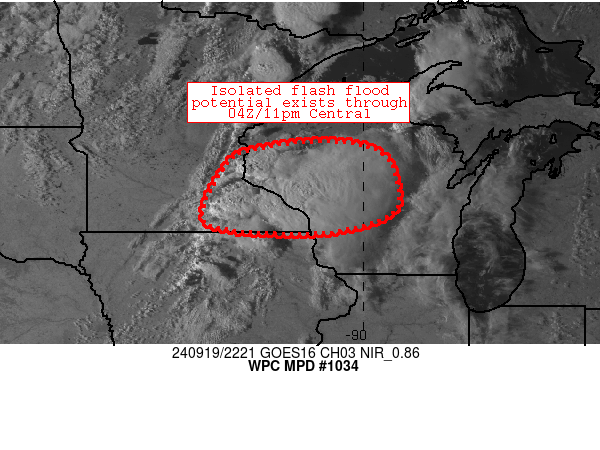
Areas affected...portions of southern/central Minnesota and
Wisconsin

Concerning...Heavy rainfall...Flash flooding possible

Valid 192228Z - 200428Z

Summary...Isolated/localized flash flood potential exists through
the early afternoon as a complex of thunderstorms produce heavy
rainfall across the discussion area.

Discussion...Over the past 1-2 hours, progressive convection has
increased in coverage and evolved into a more organized/focused
area of cells and linear segments generally extending from near
LaCrosse to Owatonna (along I-90/US 14).  These storms were in a
moist, unstable warm sector, with 1.5 inch PW values and ~2000
J/kg MLCAPE values supporting robust updrafts and spots of 1
inch/hr rain rates.  The storms were embedded in fairly strong
flow aloft (resulting in 40-kt storm motions), but were oriented
favorably for training especially along the aforementioned I-90/US
14 corridor.  As cells continue to mature in this corridor (while
migrating east-northeastward into Wisconsin), the expectation is
that a few areas of rain rates approaching 2 inches/hr could
materialize and cause isolated/localized flash flood issues
through at least 03Z tonight.

The complex will produce these rain rates atop areas of ground
conditions that exhibit slightly more sensitivity with
northeastward extent.  Soils are more moist in central Wisconsin,
and FFGs are slightly lower there (1.5 inch/hr thresholds)
compared to the remainder of the discussion area (closer to 2
inches/hr).  The overall threat of flash flooding is a bit
conditional on heavier rain rates materializing on sensitive
soils.  This threat should persist through the 03-04Z timeframe.

Cook

ATTN...WFO...ARX...DLH...GRB...MKX...MPX...

ATTN...RFC...NCRFC...NWC...

LAT...LON   45619071 45328955 44448918 43868942 43489096
            43559310 43909375 45119316 45459238
Download in GIS format: Shapefile
| KML
Last Updated: 628 PM EDT Thu Sep 19 2024
|


