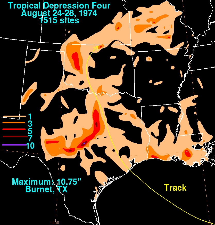
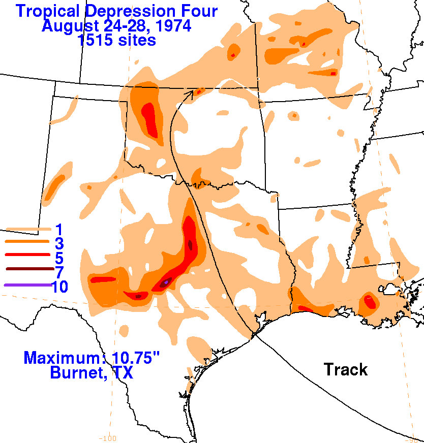
A tropical depression formed in the Florida Straits, developing
slowly as it moved west-northwest.
As it approached the upper Texas coast, the system was becoming better
organized and was on the
verge of tropical storm strength. The system moved inland and
turned northward, merging with a
frontal zone and dissipating on the 28th. Below are
the storm total rainfall maps for the depression,
using data provided
by the National Climatic Data Center in Asheville, North Carolina.
 |
 |
 |