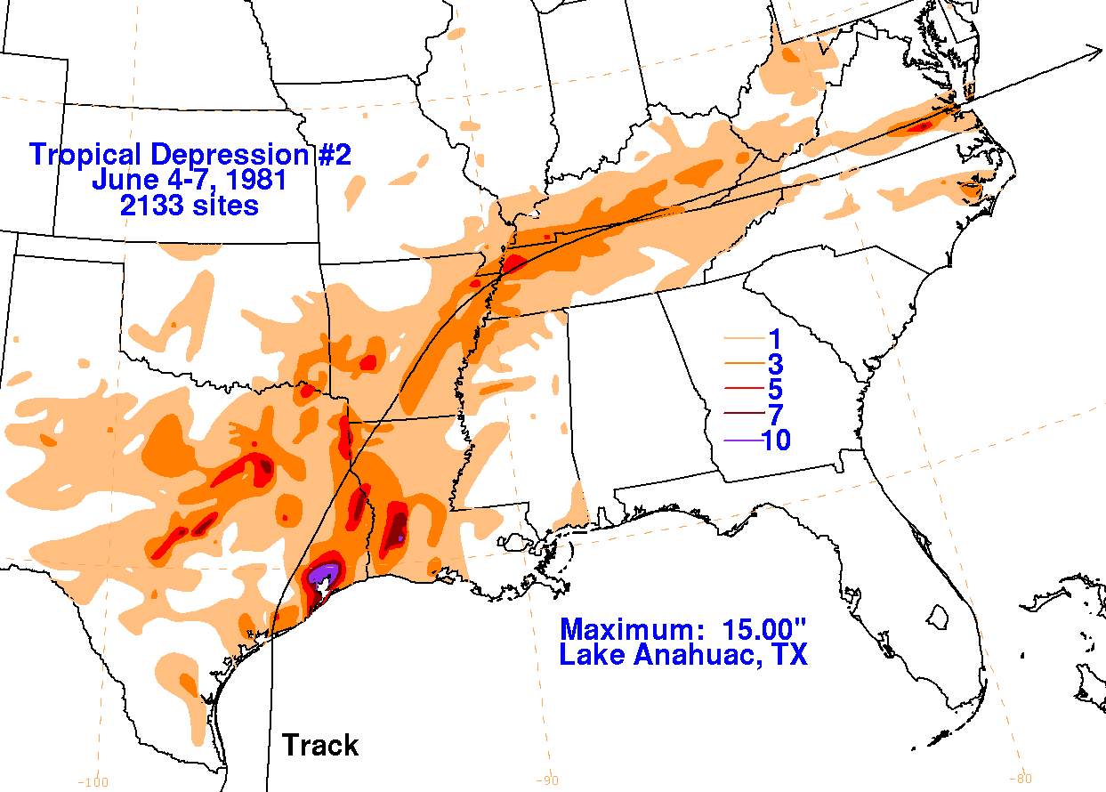
A tropical depression formed in the Bay of Campeche in a divergent
area aloft south-southeast of a
closed upper cyclone in the southern Plains. The system tracked
northward through the western Gulf
of Mexico, strengthening until making landfall upon the middle Texas
coast on June 5th. The cyclone's
central pressure fell to between 991 and 996 hPa by the time of
landfall, based on surface observations.
Galveston Scholes Field recorded a maximum sustained wind of 41 mph as
the system passed by. A
total of nine tornadoes touched down due to the depression, with 8 of
the tornadoes spawned across
Louisiana. Three people died from the system; two related to
flooding and one due to a tornado.
Heavy rainfall occurred across central Texas as moisture from the
depression interacted with the upper
level low, while heavy rainfall more directly related to the tropical
depression's circulation deluged
the Houston metropolitan area and portions of western Louisiana.
The cyclone recurved into the Tennessee
Valley, with the system deepening once again as it moved offshore the
Mid-Atlantic coast as a non-frontal
low pressure area on the 7th. Damage from the system totaled at
least $4 million. Below are the storm
total rainfall
maps for the
depression, using data
provided by the National Climatic Data Center through
their daily rainfall
totals. The track was provided by the National Hurricane
Center, then extended to
the northeast based on
archived HPC surface analyses.
 |
 |
 |